KTS-472R6LC
Single: $ 5,330
One Set: $ 6,255
This model features WinCE6.0 operation system and advanced mapping software with graphic display, as well as BT and wifi
![]()
MAPPING SOFTWARE GRPHIC DISPLAY
This advanced Total Station employs a series of mapping software to choose by users. Such as Microsurvey FieldGenius, KOLIDA Engineering Genius. User can customize their own programs too.
![]()
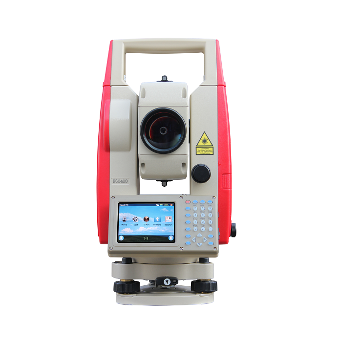
HIGHEST DEFINITION SCREEN IN ITS CLASS
640×480 LCD touch screen display on both sides gives surveyors a clear, colourful and fully graphical environment, user can easily find details on their high resolution drawing/ designing/ background map.
![]()
BLUETOOTH & WIFI
An external controllers can be linked to total station, through the Bluetooth™ wireless connection.
Data transfer can be realized via both Bluetooth and wifi.
![]()
TEMPERATURE & PRESSURE SENSORS
Temperature and pressure changes have a negative impact on the accuracy of distance measurements. The Smart T-P Sensor automatically monitors the changes and adjusts the distance calculations.
![]()
LONG DISTANCE MEASUREMENT
Thanks to the high efficiency EDM, 472 features long distance measurements: 600/1000m in reflectorless mode and up to 5000m using a single prism, with millimeter accuracy.
![]()
FAST, ACCURATE, RELIABLE EDM
The fastest distance measuring speed is down to 0.1 to 0.3 second, with 2mm accuracy, makes any job extremely cost effective and reliable.
![]()
LARGE MEMORY EASY DATA MANAGEMENT
The 512Mb internal memory and SD card up to 32 Gb can store a huge amount of data. Users don’t need to worry about memory space. Easily operation on data adding, deleting, modifying, transferring.Total station can be recognized as a flash memory disk by PC.
| Distance Measurement | ||
| Measurement Range
1 prism: 5000m 3 prism: 8000-10000m Reflectorless: 600/1000m |
Accuracy
Prism: ±(2+2ppmx D)mm Reflectorless: ±(3+2ppmx D)mm |
Measuring Time
0.1 – 1.5s |
| Atmosphere Correction
Auto Input |
Prism Constant Correction
Auto Input |
|
| Angle Measurement | ||
| Measurement Me
Absolute Encoding |
Accuracy
2″ |
Minimum Reading
1″/ 5″ optional |
| Compensator
Dual Axis Liquid-electric Range ±4′, Accuracy 1″ |
||
| User Interaction | ||
| Operation System
WindowsCE 6.0 |
Color Screen
YES, 3.5″, 640x480pixs |
Touch Screen
YES |
| Keyboard
Full Alphanumeric keys with backlight |
Trigger Key
N/A |
Bluetooth & wifi
YES |
| Internal Storage
512Mb |
External Storage
up to 32GB SD card |
|
| Working Capability | ||
| Program
Coordinate measurement, setout, area, road design… |
Graphic Display
YES |
Laser Pointer & Laser Plummet
Yes |
| Endurance
10-12 hours |
Setout Guide Light
N/A |
Camera Function
N/A |
© 2015 - 2026 Geoapplied Co.Ltd. All rights reserved.
Powered by Insight Web Studio